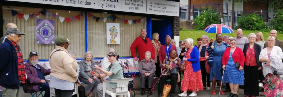
Two online maps have been launched to help Blue Badge holders and other road users navigate around Leeds city centre as major road improvements are carried out and completed.
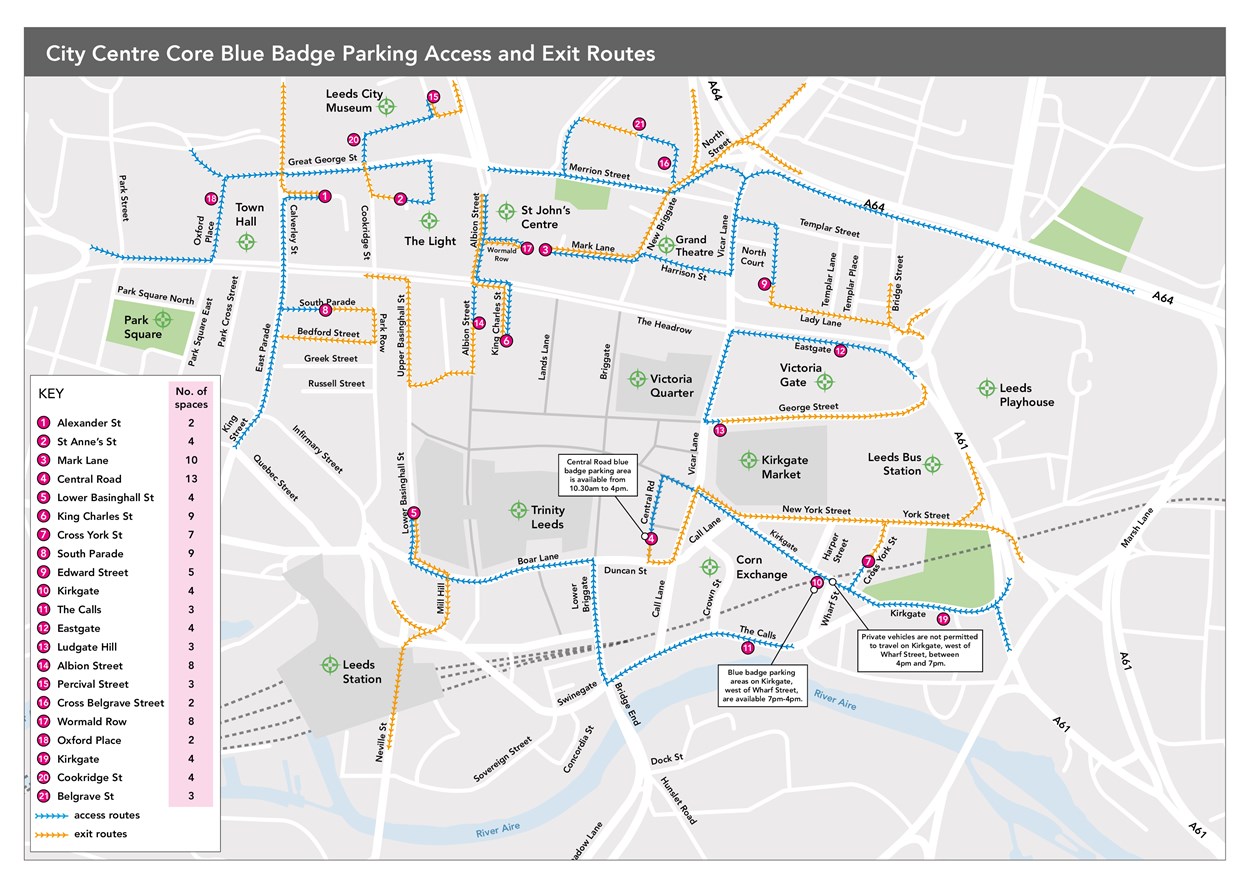
The disabled parking map shows the on-street locations where Blue Badge holders can park, with 111 spaces allocated across 21 different locations in the city centre. How to access the spaces and the direction of travel to them is shown on the map in blue, whilst the exit routes are shown in yellow. Everyone registered with the council as a Blue Badge holder will also receive a link to an online version of the and can request a physical copy of the map.
You can view or download the blue badge parking map here https://news.leeds.gov.uk/resources/new-disabled-routes-map-final (note you may need to download it to zoom in on different parts of the map)
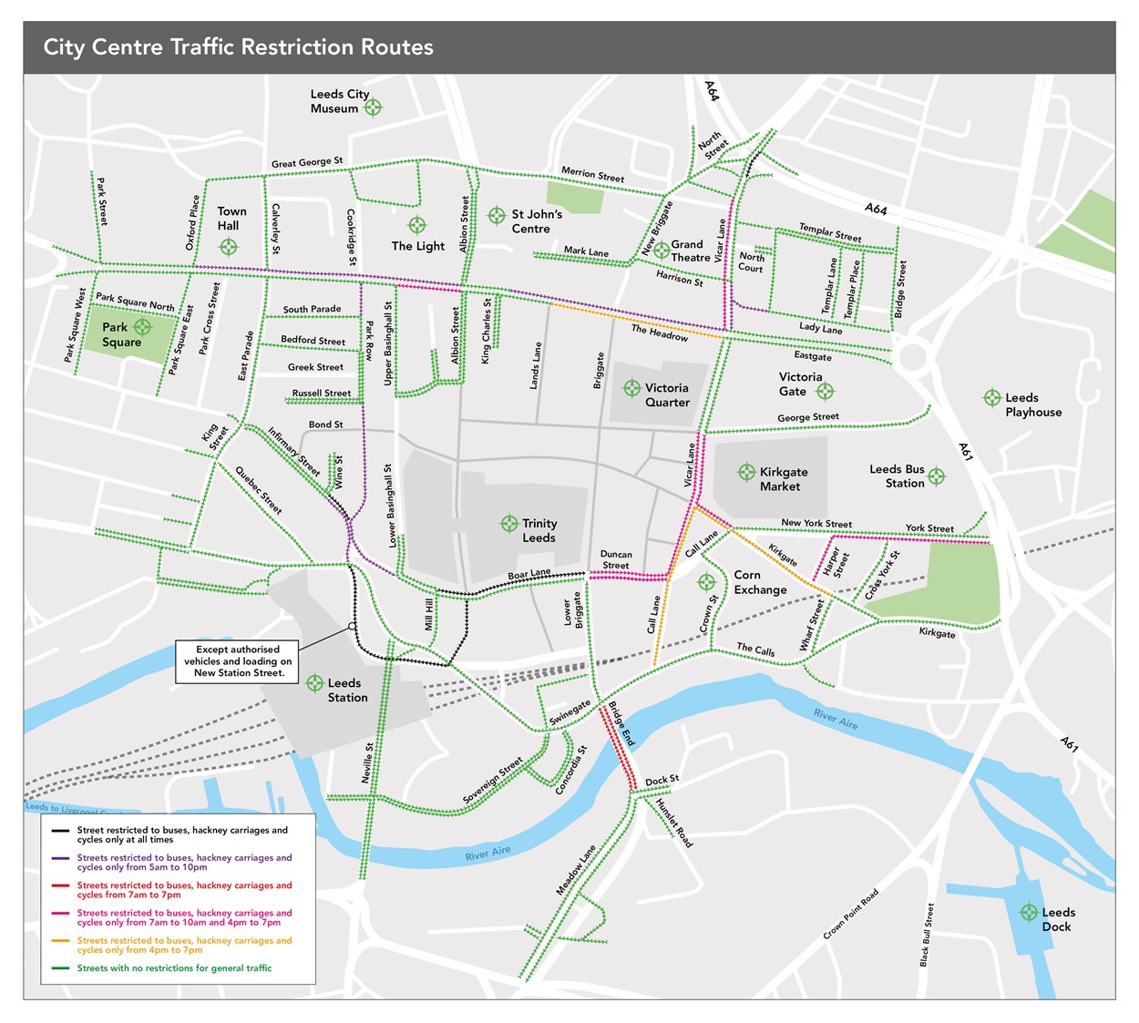
The second map shows which roads have restricted access and at what times. Where there are no restrictions at any time, roads are shown in green. However, others including The Headrow, Vicar Lane and Call Lane restrict access to certain road users at specific times of the day. For example, a large section of Vicar Lane is restricted to only buses, hackney carriages and cycles between 7am – 10am and between 4pm – 7pm.
You can view or download the current restrictions map here https://news.leeds.gov.uk/resources/current-restrictions-map-final (note you may need to download it to zoom in on different parts of the map)
The new restrictions will be enforced by cameras and Penalty Charge Notices will be issued for infringements. Some of the restrictions are already being enforced. Cameras for several of the new restrictions will be activated over the coming months and the public will be notified when new cameras are to be activated. All funds from this will be reinvested into making improvements to the Leeds transport network.
The maps have been created following discussions with stakeholders, to help ensure people can find their way around the city centre during the ongoing major improvements. These changes are part of the £173.5million Leeds Public Transport Investment Programme as part of Connecting Leeds, that aims to dramatically improve public transport and cycling and walking infrastructure across Leeds. It has been shaped from public consultations including the Transport Conversation in 2016, the City Centre consultation in 2018 and consultations on the Headrow and Corn Exchange improvements in 2019.
In these consultations, members of the public asked for:
- priority for buses, pedestrians and cyclists above private vehicles
- the retention of access routes to city centre public car parks and delivery routes for businesses
- easy access for blue badge parking
- bus gates to increase the reliability of buses travelling through the city centre (A ‘bus gate’ is a short section of road where access is restricted to buses, hackney carriages and pedal cycles only at certain times (as specified by the signage)).
- enforceable and meaningful restrictions for private vehicle users
- access maintained to important Leeds landmarks such as the first direct arena, the universities, Leeds General Infirmary, and Leeds Playhouse.
The maps will be further updated once future city centre improvement works have been delivered.
